Dongji Island Introduction
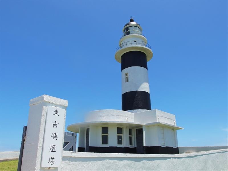
Did you know that there is a marine national park in Penghu? The Southern Four Islands National Park includes Dongji, Xiji, Dongyuping, and Xiyuping islands, along with surrounding islets and waters. Due to the sparse population, it retains its primitive appearance and is an important ecotourism destination. The easternmost island, Dongji, is the largest among the Southern Four Islands and is also the closest island to Taiwan in the Penghu archipelago. It once served as a transit point for maritime trade between Taiwan and Penghu. The nearby waters are known for numerous spiral currents, often causing ships to run aground and sink, which has led to its nickname "Black Water Ditch." To ensure the safety of vessels, two lighthouses were built during the Japanese occupation; the northern Dongji Lighthouse is the highest point on the island, characterized by its striking black-and-white striped tower. Additionally, remnants of military barracks, locally referred to as "Bingcuo," can be seen on the northeast corner, where the Japanese military was stationed. If you head west from the visitor center to Bagua Mountain, you can climb to a high point for a view of the Dongji dock, Dongji Lighthouse, and the surrounding sea. The rock formation of Bagua Mountain consists of long and narrow basalt columns, with a round rock resembling an eye on the left, known as the "Eye of Dongji." The coastline around Dongji Island is almost entirely composed of steep columnar basalt cliffs, and there is a massive sea-eroded platform on the northeast corner, locally named "Daping," where numerous intertidal organisms can be found at low tide. Due to its rich basalt landscape, Dongji, along with Xiji, Toukang, and Tiezhen Islets, has been collectively designated as the "Penghu Southern Sea Basalt Nature Reserve."
 Dongji Islet
 Dongji Island


