Flower Island Introduction
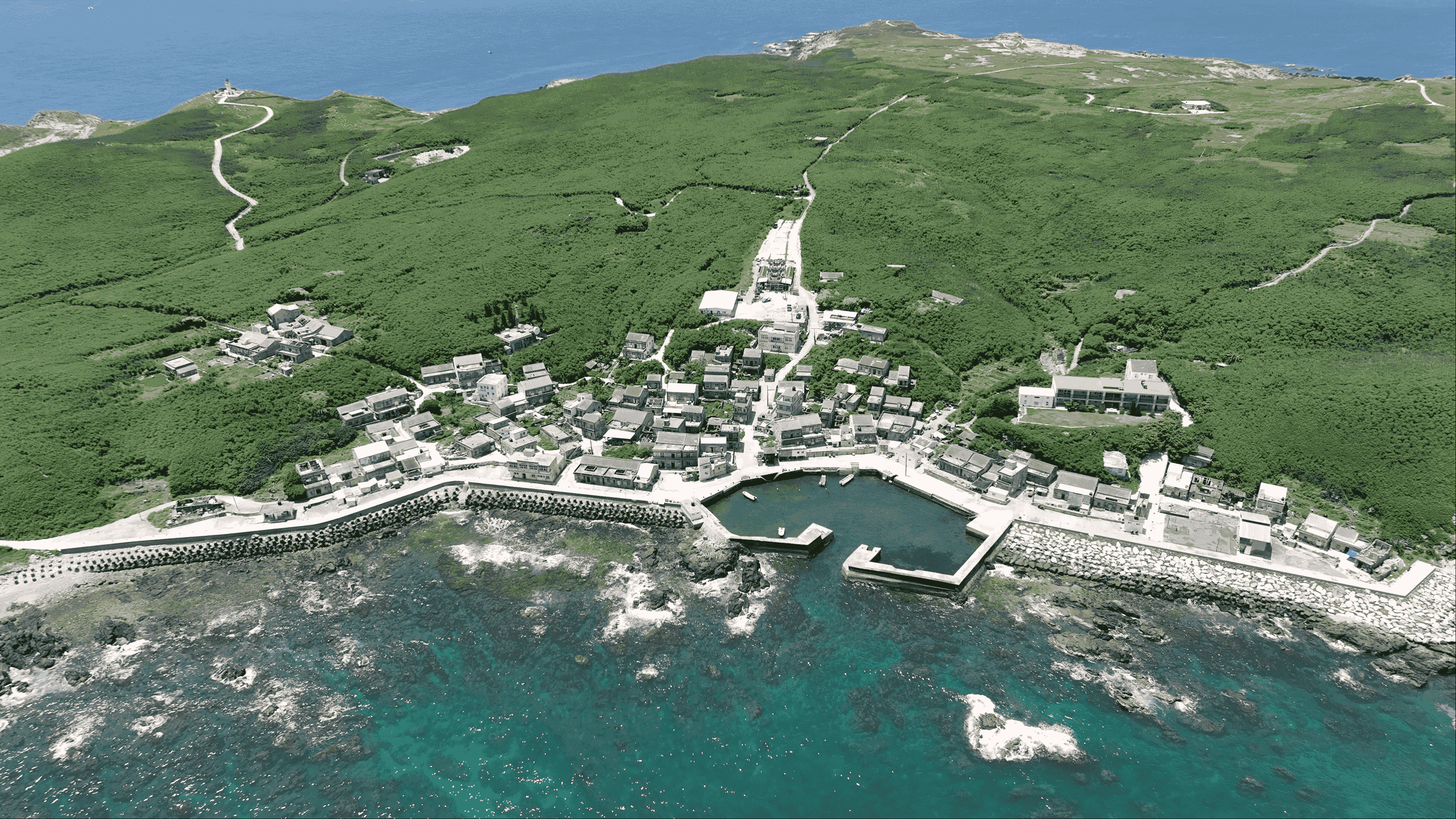
The volcanic rock geology of the Penghu Islands is primarily basalt, with the only exception being Huayu Islet, which is composed of andesite. Andesite is a type of volcanic rock formed by the rapid cooling of lava, characterized by high viscosity and slow flow, typically accumulating near volcanic craters in conical shapes, distinct from the squared mountains formed by basalt. It was formed approximately 65 million years ago and is the oldest and westernmost island of Penghu. Huayu Islet is located northwest of Wang-an, and the island hosts nearly a hundred species of native plants, which is how it got its name. Currently, there are only about a hundred residents, as the confluence of the Kuroshio current and the Tsushima current yields abundant fish catches, with most residents relying on fishing for their livelihood. The highest point on the island is Yandun Mountain in the eastern part, which stands at fifty-three meters above sea level. The western part of the mountain features the Huayu Lighthouse, a pure white structure built of reinforced concrete, making it the westernmost lighthouse in Taiwan and an important landmark of Huayu Islet. On the southeastern reefs, there are also the legendary "immortal footprints" of Lü Dongbin, with the left footprint matching the right footprint on Tiantai Mountain of Wang-an Island, though they are only visible during low tide!


