Nanzih Lin Trail Introduction
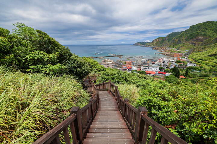
The Nanzilin Trail, commonly known as "Nanzi Mian," is hidden behind the Nanya Fishing Port in Ruifang. The name refers to its location south of the Shuimen Cave leading to Bitou Cape. The trail is well-planned, featuring a wooden walkway in the front section and stone steps in the middle to the rear section, making it easy to walk. From the elevated points, visitors can enjoy panoramic views of the northeastern coast, with its beautiful bays and cascading green mountains. It is a highly accessible scenic trail that showcases both mountain and sea landscapes.


