Manabang Mountain Hiking Trail Introduction
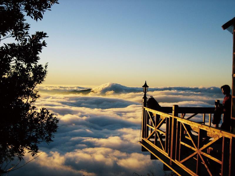
Manabanshan, located at the boundary of Dahu Township and Tai'an Township, stands at an elevation of 1,406 meters. It is often shrouded in mist and offers a magnificent view of the sea of clouds, making it a stunning sight. The ancient battlefield monument on the mountain is one of the most renowned spots for maple leaf viewing in Taiwan. Every autumn and winter, the mountain is adorned with vibrant red maple leaves, attracting an endless stream of visitors who come to appreciate the scenery. It is famously known as the "North Matsu (Manabanshan) and South Aowanda (Aowanda National Forest Recreation Area)." There are three routes to ascend Manabanshan: the "Donghsing Natural Lake Route," "Donghsing Upper Lake Route," and "Donghsing Zhu Lake Route." [Donghsing Natural Lake Route] Trailhead - Natural Lake - Beech Forest - Big Rock Wall - Manabanshan Along the Natural Lake Route, there is a strawberry farm where sweet red strawberries can be harvested between December and February each year. Next to the Natural Lake, you can see a lush beech forest. After passing the Big Rock Wall, you will reach the summit of Manabanshan. [Donghsing Zhu Lake Route] Changqiao Shiziting (Trailhead) - Fork - Ancient Battlefield - Shimen - Manabanshan The best maple viewing section is between Shimen and the ancient battlefield monument. You can choose to walk through the straight bamboo forest along a curved path, visit Tiandiao Cave (home to bats), or stroll along the well-preserved, pristine Zhu Lake Route to enjoy the beautiful maple views. The ancient battlefield and Shimen preserve the heroic legacy of the Tayal people's resistance against Japanese rule, telling the story of the past. Upon reaching the summit, you will have a panoramic view of the spectacular Sacred Ridge line between Xueshan and Daban Mountain, witnessing the swirling sea of clouds from a high vantage point, making this place a wondrous sight. The expansive mountain forest scenery will leave any visitor in awe!


