Guang Tian Gao Mountain Trail Introduction
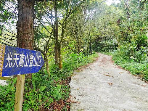
Guangtian Mountain is located southwest of the Xiangtian Lake village in Sanjhuang Township, Miaoli County, standing at 1,123 meters. It was historically a hunting and logging area for the Saisiyat people and is now designated as reserved land of the 32nd Forest Management Unit of the Forestry Bureau. The trail leading to Guangtian Mountain features a well-preserved forest environment, with ample shade and excellent views from the ridgeline, allowing visitors to overlook nearby villages, the continuous mountain ranges, and beautiful scenery. Along the way, visitors can also stop by Xiangtian Lake and the Saisiyat Cultural Hall in Miaoli County to enjoy the picturesque setting of the lake, mountains, and the reflection of the mist, while leisurely sipping tea by the lakeside, walking along the lake trail, and learning about Saisiyat culture, making it a favorite among mountain enthusiasts. Starting from the trailhead, both sides of the entrance are adorned with blooming purple flowers of the purple flower mint, forming a sea of purple. Following the path through the fragrant bamboo grove and cedar forest, one ascends gradually. At a fork in the trail, the left leads to Xiangtian Lake Mountain while the right goes to Guangtian Mountain; both paths are connected, forming a loop, allowing hikers to visit both Guangtian Mountain and Xiangtian Lake Mountain as per the trail markers. Heading right towards Guangtian Mountain, there is a high platform on the left side of the ridgeline, providing an excellent lookout point over Xiangtian Lake village, Guogong Mountain, Lu'aijiao, and Xiangtian Lake. The trail is dense with trees, with towering cedars seemingly reaching the sky, and sunlight dapples through the branches, causing hikers to pause in appreciation. Continuing along the path past giant boulders, the trail climbs upward, with various ferns and flowers abundant in the undergrowth. Soon, a flatter elevated area is reached, suitable for a brief rest, and the Ping Mountain boundary water marker is on the left. Further ahead, at the edge of the saddle, dense trees and paths appear, and one follows natural steps formed by exposed tree roots, ascending onto the ridgeline and heading west until reaching the summit. At the northeastern summit, one can find a fourth-order triangulation point, with tall oak trees standing around. Although some views are obstructed by the surrounding tall trees, the northeastern cliff allows a view of Guogong Mountain while the western side offers a glimpse of the Taiwan Strait. At the summit, enjoy the gentle breeze, stretch out, and breathe in the fresh mountain air. 1. Starting point: Xiangtian Lake village to Guangtian Mountain triangulation point (Nanjiang village) 2. Trailhead: Above the left side of No. 18 residence in Xiangtian Lake village 3. Trail length: 3 kilometers, walking time: approximately 1 hour and 50 minutes one way 4. Trail route: Guangtian Mountain trailhead → high platform by the ridgeline → giant boulder → "Ping Mountain boundary landmark plateau" → Guangtian Mountain


