Cape Gele Lighthouse Introduction
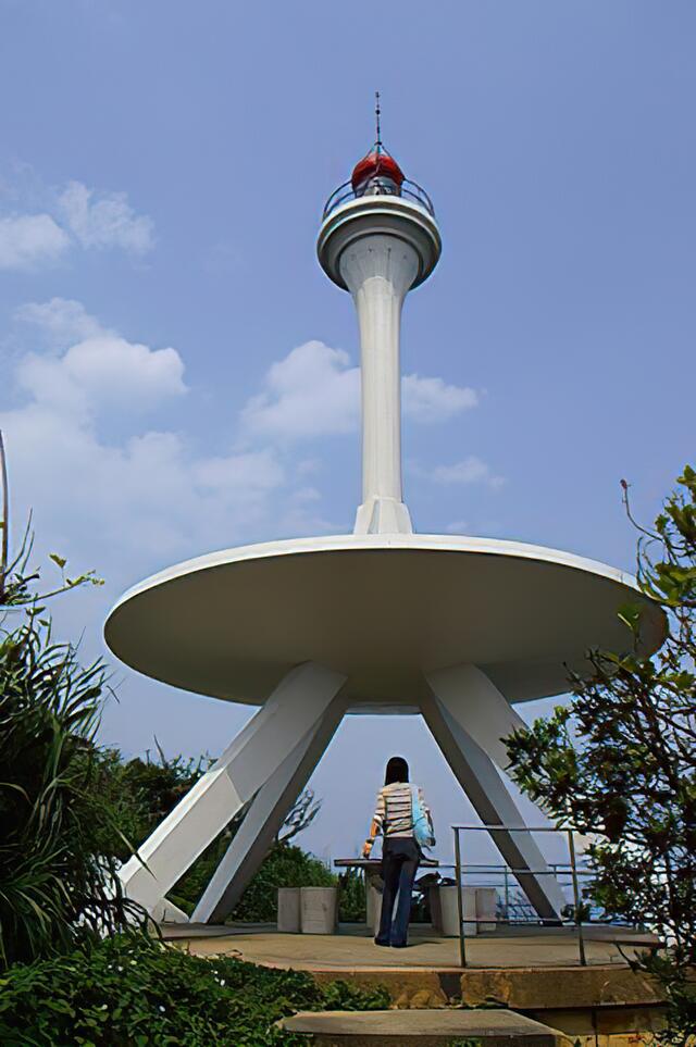
The Yehliu Lighthouse was established in 1967, standing at a height of 11.3 meters. It is located at the highest point of Guihou Mountain in the third area of Yehliu Geopark, accessible via a branch path from the main trail at the cape. Designed in the shape of a candlestick to complement the renowned landscape of Yehliu, it takes inspiration from the candlestick rock. The lighthouse was set up between the light ranges of the Fuguei Cape Lighthouse and the Keelung Lighthouse to enhance navigation for Keelung Harbor.