Yehliu Village Hiking Trail Introduction
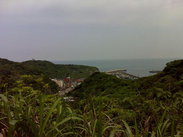
The Yehliu Li Hiking Trail, located in Wanli District, New Taipei City, is a community trail directly facing Yehliu Fishing Port. Enter the alley next to No. 3, Gangdong Road, from the Agricultural Association, and you will see the steps leading up. The trail is approximately 1 kilometer long, featuring lush greenery, a wide and gentle path that is easy to walk, and two viewing platforms along the way. These platforms offer views of Yehliu Fishing Port, Yehliu Geopark at Yehliu Cape, as well as the endless Pacific Ocean. The trail ends at Ren'ai Home, where the plaza provides a view of Emerald Bay. On the return trip, you can also visit the century-old Mazu Residence and the Laogu House Trail, which is about 0.97 kilometers long, with a walking time of approximately 35 minutes. This trail is family-friendly and is located near Yehliu Geopark.