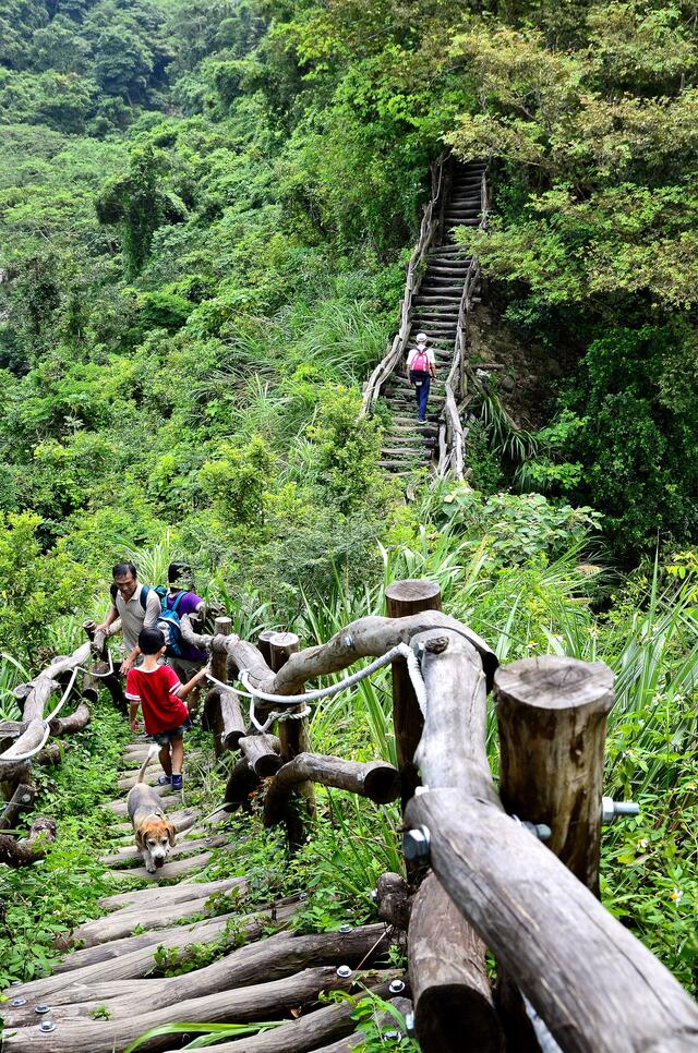
Dahu Recreation Area No. 2 Trail (Closed) Introduction
無
無
Address:Intersection of Qingshui Lane and Liankeng Lane, Beitun District, Taichung City 406
無
Dahu Recreation Area No. 2 Trail (Closed) Travel Information
Address:Intersection of Qingshui Lane and Liankeng Lane, Beitun District, Taichung City 406
Transportation Methods:Taichung Bus (Taichung Station 04-22224102): Route 15, Route 16 (boarding at Lvchuan East Station) can also reach Chung Tai University; additionally, at the intersection of Dongshan Road and Songzhu Road, you can take Taichung Bus Route 66 (Route 66 will loop inside Dakeng). 2. Renyou Bus (04-22255166): Route 1, Route 20, Route 21, Route 31 (boarding at Lvchuan East Station, recommended to take Renyou as there are more buses). 3. Fengyuan Bus (Taichung North Station 04-22223435): bus routes heading towards Zhongxingling, Xinshe, Dongshi, etc.
Remarks:1. It is recommended that the elderly and individuals with hypertension avoid climbing the Dakeng Trails No. 1 to 5 and No. 5-1. 2. The Dakeng Trail No. 4 has a significant elevation change, with a vertical steep slope of 300 meters in one section. 3. Generally, the Dakeng Trails No. 6, 7, 8, 9, and 9-1 are more suitable for both men and women...
Other Nearby Attractions: Dakeng No. 3 Trail (Closed) 、 Dakeng No. 1 Trail Fitness Training Area 、 Dakeng No. 1 Trail 、 Dakeng No. 4 Hiking Trail (Closed) 、 Dakeng No. 5 (Closed) and No. 5-1 Hiking Trail 、 Zhongzheng Camping Area 、 Shenghe Mushroom Farm 、 Xinshe Commercial Area 、 Xinshe Star Wish Purple Windmill 、 Hione World
Nearby Cuisine: Mushroom God Scenic Complex Restaurant 、 Dragon's Nest Chicken City 、 Zhenhua Mushroom Delicacies 、 A-Liang Mushroom Farm 、 A Smoke Again 、 Hione World 、 Gu Ming Chicken City 、 Pear Cafe - Chongde Branch 、 DK9 Daken No. 9 、 Annie's Garden


