Longkeng Ecological Protection Area Introduction
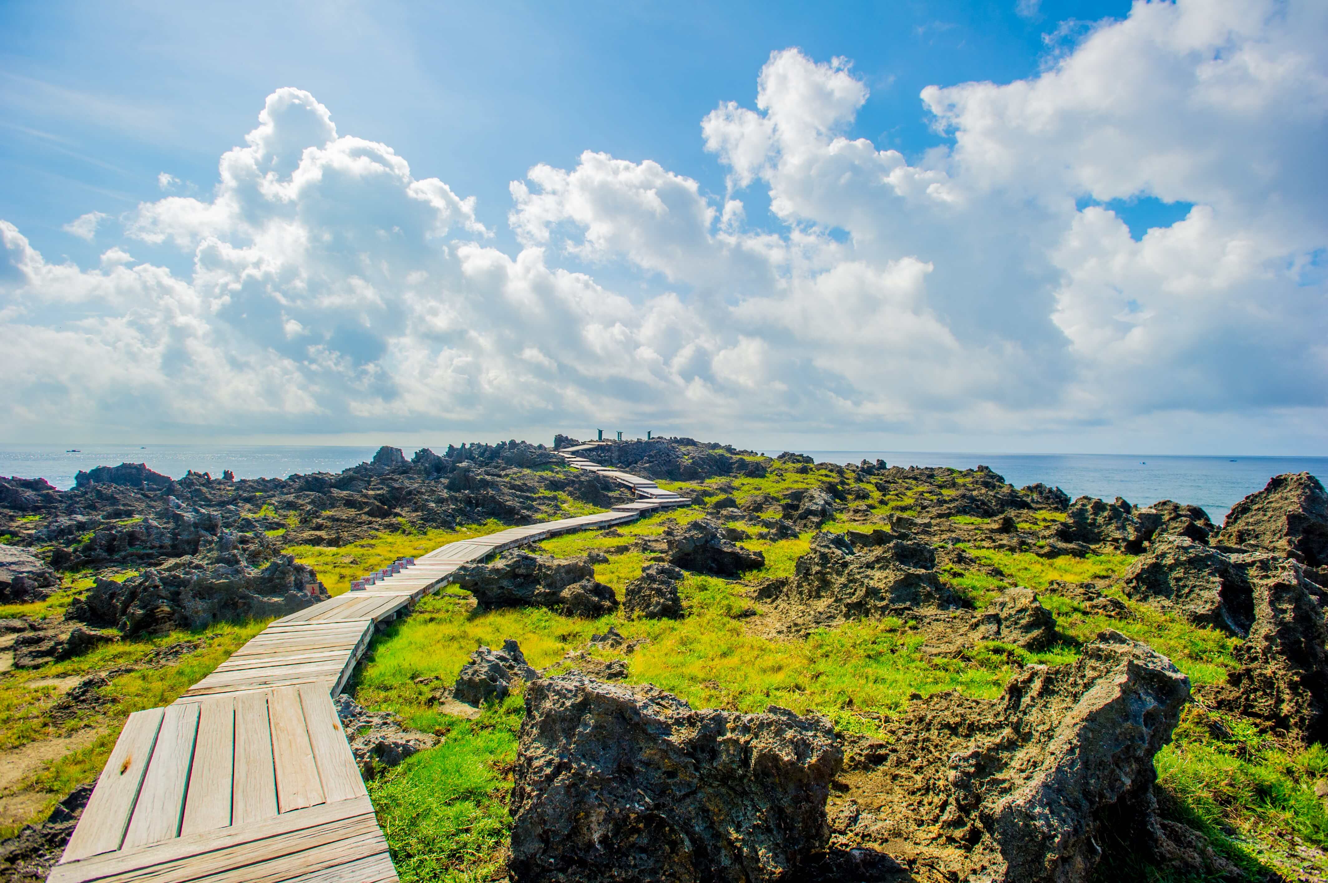
Located at the starting point of Jiae Highway, Longkeng is an uplifted coral reef known for its rugged and wild terrain. The extensive erosion has shaped the entire area into unique formations including cliff skirts and canyons. Longkeng gets its name from its dragon-like shape. The topography of Longkeng can be divided into five parts: coastal grasslands, coral reef plateaus, canyons, karst formations, and cliffs. The grasslands are home to large groups of whitewater trees, while the coral reefs feature vast areas of sea roses, making it the largest population in Taiwan. The imposing scenery is complemented by steep rocky shores, creating an atmosphere reminiscent of a primordial Jurassic Park. Access to the Longkeng Ecological Preservation Area requires prior approval from the Kenting National Park Management Office.
 Longkeng Nature Ecological Reserve
 Rugged and primitive geological landscapes


