Bantianyan Faith Trail Introduction
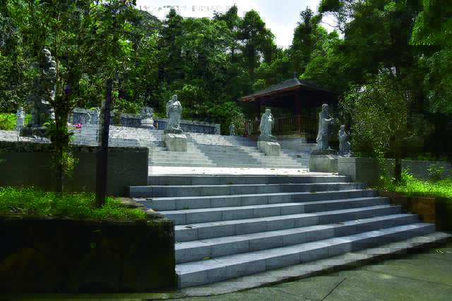
Bantian Rock originally had a recreational area limited to the vicinity of Ziyun Temple and Shenglong Guanyin Square. In 2009, the Alishan National Scenic Area Administration connected nearby farm roads and built pavilions and other facilities, transforming it into this hiking trail. The two ends of the trail are located at the western side in "Shitou Gong Park," and on the eastern side at the intersection of County Road 159甲 and Township Road 嘉124. Starting from Shitou Gong Park, you first arrive at "Cai Cuo," a settlement formed by the Cai family. The simple rural atmosphere feels reminiscent of times gone by. Entering deeper into the mountains along the farm roads, persimmon and citrus trees showcase beautiful rural scenery. The diverse low-altitude secondary forests along the way, with broadleaf trees and later-planted sweet gum and cedar, as well as interspersed plants like arum and gloriosa lilies, vibrantly display life, while the sounds of insects and birds among the treetops and bushes are full of vitality. After a few gentle bends, the "Luohan Square," with its eighteen arhats, illustrates their individual origins and stories with varying postures and expressions. Continuing forward, pause at a rest pavilion and viewing platform where you can gaze out over the plain, then follow the wooden steps down to reach the other entrance, completing this trail journey. DATA Trail length: approximately 1,880 meters Walking time: about 120 minutes one way Challenge level: 2 (Courageous Foot Level) Entrance A: next to Shitou Gong Park GPS: 23°27'46.6"N 120°35'52.6"E Entrance B: intersection of "159甲" and "嘉124" GPS: 23°27'35.9"N 120°36'15.2"E


