Xianrenkeng Trail Introduction
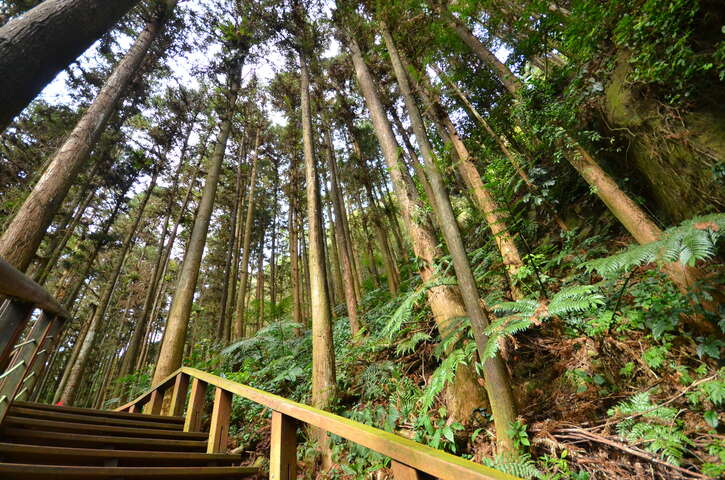
The Xianrenpu Trail has three entrances, located near County Road 162甲 at the 14 km point and two entrances on Township Road 154. Besides retracing the original path, you can also take a roundabout route along the nearby roads. Waterfalls, streams, and traces of water erosion on the rocks are significant features of the Xianrenpu Trail's landscape. Entering from the northern end at the bridge, you will immediately see a pot hole on the giant boulder underneath the bridge. As you descend the stairs, water erosion marks can be found on the rock walls and stones. Among them, the most famous are "Yuluodong," shaped like a conch fossil, and “Xianjiao Yin,” giving rise to legends of immortals once visiting this place. Descending to the junction of the trail that approaches the valley, one path crosses the stream and leads to an entrance about 0.5 kilometers from Township Road 154; the other extends south toward the starting point of Township Road 154. Walking into the southbound wooden boardwalk, you will be surrounded by a large forest of cedar trees. Besides the welcoming cedar trees on either side, you can also see various indigenous shrubs and ferns of Taiwan. Although this section of the trail seems long, with only a small uphill segment at the northern starting point, the elevation changes are minimal, making it quite easy to walk. It takes about 30 minutes to reach the southern entrance, making it a suitable route for family outings. If you choose to return to the starting point via Township Road 154, you can enjoy interesting views of the trail winding through the woods and observe the changes in the forest composition and scenery along the way. This segment of less than 500 meters will not take much of your time or energy, and you will arrive at the entrance near Township Road 154 about 0.5 kilometers away. From there, descending the stairs leads you back to the original trail junction. DATA Trail Length: Approximately 900 meters Walking Time: Approximately 50 minutes Difficulty Level: Level 1 (family-friendly) Entrance A: Near the starting point of Township Road 154 GPS: 23°33'37.1"N 120°36'34.1"E Entrance B: Near 14 km of County Road 162甲 GPS: 23°33'44.6"N 120°36'42.8"E Entrance C: Near 0.5 km of Township Road 154 GPS: 23°33'42.8"N 120°36'44.1"E


